Molly has four types of satellite communication, each with its own features and benefits. Let’s get into the details of each of these.
Voice Communications via Sat Phone
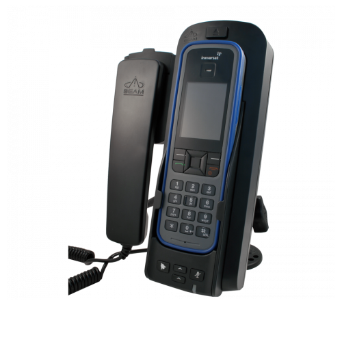
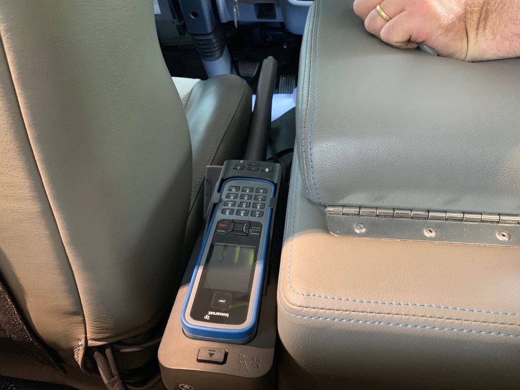
Molly is old school, with an Inmarsat based Satellite Phone. How old school? Well, Inmarsat put its first satellite into orbit in 1976, although the current generation of satellites is from the mid 2000’s. We have owned our Satellite Phone for many years and it has travelled half around the world with us. With Molly we made some significant improvements with a more permanent solution. On our previous overland trip, the Sat Phone was hidden away, only to be pulled out and used when it was needed. This approach was fine, but meant it was off and was only for making outbound calls.
In Molly, the Sat Phone is permanently mounted in a docking station which connected to a external satellite antenna, mounted high on the roof of the cab to provide the best possible visibility to the skies. This new arrangement provides better quality of connection to the Inmarsat network, but more importantly, the Sat Phone is now also always powered on. This always-on approach means we are constantly confirming that we can register with the Satellite network, we know the phone battery is always fully charged, and most importantly, means others can calls us. We are currently subscribed to the cheapest, low-call-volume monthly plan we can find. This works out at about $1 USD per minute, if used. Essentially the Sat Phone is an emergency only option.
Tracking via SPOT
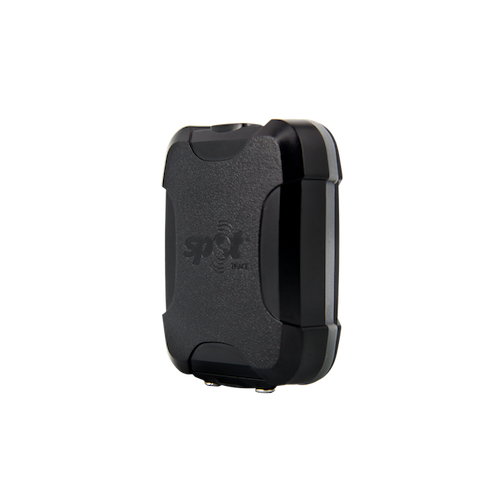
SPOT is our vehicle tracking device, connected to a Globalstar satellite network. This means Molly’s movements are constantly being tracked in real-time. When the device detects movement it sends a short message every 10 minutes with its current location to the SPOT servers. Our device is the Trace model, which is a one-way tracking device, and can only transmit tracking points up to the satellites. It is not possible to receive messages (at least not messages we can see).
With some software we wrote, we are able to query the SPOT network and automatically retrieve the location points, store these location points into a database and then create maps of our journeys from the tracking point database.
Messaging via Garmin inReach
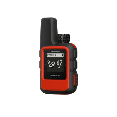
We have two Garmin inReach Mini devices that can send and receive messages via the Iridium satellite network. These are small portable devices that we use when we go hiking, and, they also have an interactive SOS feature, which can be activated in an emergency. The Garmin inReach can also request and receive weather forecasts, a particularly useful feature when travelling overland and internationally.
Like the SPOT tracker, we can query the Garmin network and automatically add track points to our database and maps.
The other nice use for the inReach devices, is just to send short text messages to each other or to our friends. There is a small delay, unto 10 minutes, between messages, because of the way the inReach devices checks for new messages. But still, very useful and we use this feature often.
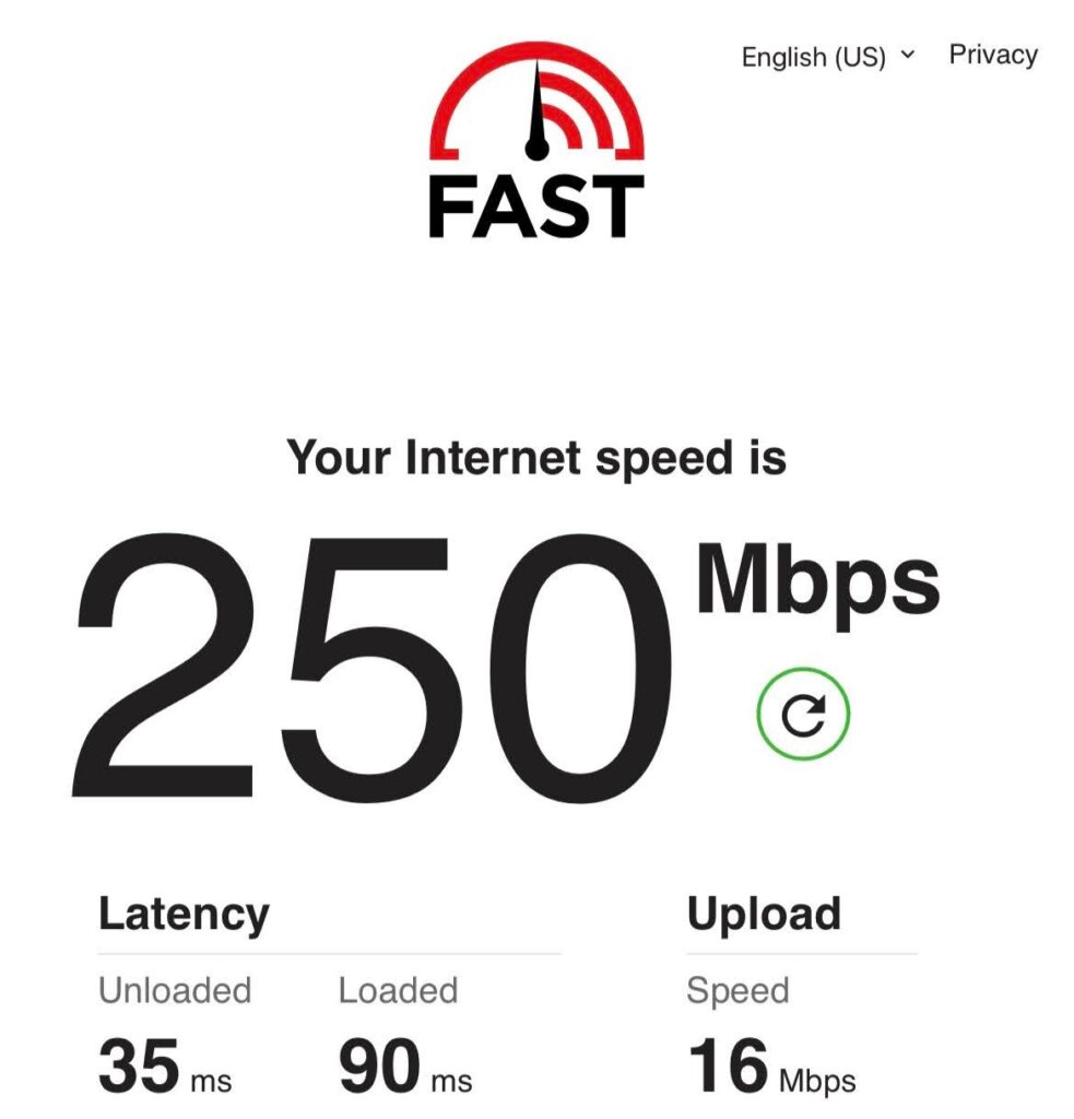
Internet via Starlink
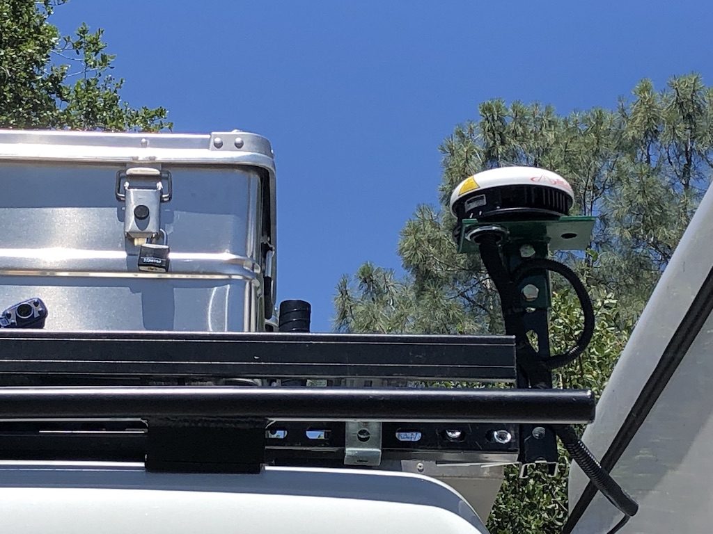
We have a generation 2 Starlink dish with portability enabled. This allows us to roam around North America and get high quality internet, at least when we have a view of the sky. Typically we like to park in the shade and under trees, which is not great for satellite signals. Fortunately, the Starlink dish comes with its own little stand and extension cable, so it is possible to position the dish in a different place than Molly. We also have a pole that we can mount on the rear bumper, for those occasions we do have a view of the sky. More information on the installation at the following link.
Diversity Rules
Granted, we have more satellite technology than is typical, but each has its own function and benefits. Firstly, all four devices use different satellite networks, providing nice technology and network diversity. Secondly, each device performs well at one specific function: the Sat Phone for voice, the SPOT Trace for vehicle tracking, the Garmin inReach Mini for messaging and portability and Starlink for high speed Internet.
This diversity results in four concurrent service or monthly subscription charges. This is a monthly charge we are happy to pay, as it is good insurance, knowing we can get help if we need it.
Coverage Maps
Iridium has total global coverage; Inmarsat doesn’t the globe, but does covers everywhere we want to go (we are not planning on going to North or South Pole). The SPOT service has a few limitations, for example with no coverage in the southern tip of South America, but this is not a big deal, as the Sat Phone and the Garmin inReach devices are for safety and the SPOT is more for fun. Starlink is still building out their network, with limited coverage at the moment but full coverage of the USA.
The bigger problem with using satellite technology internationally is not the international coverage. Rather it is our ability to cross borders with satellite based technology. Some countries may choose to take exception to our gadgets. We travelled all through Australia, South East Asia, Central Asia, Eastern and Western Europe and parts of Africa with our Sat Phone and never had a problem. But one day, some official is probably going to want to make life difficult for us and we may need to walk away from our Sat Phone. The only redeeming point is that our Sat Phone is old and not worth that much anymore. Starlink does not work outside the home continent, and taking a dish to either Canada or Mexico is not reported as a problem on the forums.
On-line Map Tracking
Amazon provides a cloud based computer and storage platform where we host a small application that keeps track of us. Amazon has a free tier and this application is small enough to stay well within this free tier. Every 5 minutes the application will talk to the SPOT servers and get the last 50 tracking points sent by the SPOT Trace device. The Garmin network also sends tracking points to our Amazon application, whenever it gets one from the inReach devices. Our application then cobbles together all of these tracking points and creates an online map laid on top of Google maps.
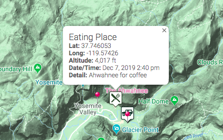
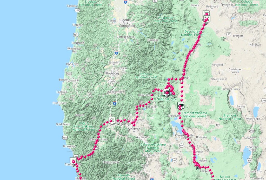
Tracking points are shown as red pins and these come from SPOT. Other points of interests, like camp sites, scenic viewpoints or eating places, can also be added to the map by sending a message from a Garmin inReach or iPhone (if in wifi or cell coverage) with a keyword and a short description to be indicated on the map. This way we can add to the map by sending the application a short message. Thus our on-line map is able to track us in near real-time, even if we have no Internet coverage. This tracking is achieved with very little effort while we travel. More on how this all works is in our Website Maps technical post.